Present:
John, Chris, Clare, Gill, Kay, Wendy, Gill
Apologies:
Pete, sally, Louise, Paula, Yvonne, Steve
Lost Routes – Restoring The Record
A summary was circulated (created by Sally). See below.
Wendy (Beaumont) has been working on this in her own area (Ditton Priors) and gave us a lot of very useful advice. A big thank you to her.
First step is to identify an area/route and then using various archive resources to research any documentation that may help to show that this was a historical right of access. Some documents and maps are available on-line e.g. Scottish Archive records do have English records available online. Aim is to find some evidence that the selected route was once a road or bridleway. Look at records from 1880 to early 1900’s. Any road at this time would naturally be for horses as cars were not in wide use plus any records to say it would have been a public use (e.g. to an Inn or cider house). Wendy had a set of Cassini Historical Maps 1831-1832, 1902-1902, 1920-1921 for our area which showed a number of routes as roads or tracks which we would be interested in making into bridleways. Gill Eyre also has some useful historical maps which we can access. At some stage a visit to Shropshire Archives will be needed.
Wendy recommended that we focus on routes which are not on current definitive maps as these are the ones we will lose in 2026.
BHS have good expertise and may be able to help and also put their names down on any paperwork (to avoid any upset with the local land owners). A couple of routes were proposed and we will need to research these further.
Council Support for Improvement Projects
Tim will organise stone and for their digger to improve Walters Lane. He would like us to first talk to Walter to make sure he is aware of plans and does not have any objections. ACTION – John to either speak to Walter or ask Steve Jones to talk to him and then let Tim know and he will go ahead. They have budgeted for this work.
Crammer Gutter to bottom of Withies Bank – Tim will look at doing some digger work on this to open up ditches (may not be until next year)
Detton to Prescott – Tim will look at doing digger work top open up ditch down to brook (may not be until next year)
Chris had separately spoken to Tim and John to Richard (Council Rights Of Way Team) and both said same. They have budget constraints and are under pressure to do paid work so are not able to commit to any more work.
Top of Crammer Gutter – ACTION Chris to chase Carl Pickup for info on what we can do regarding drainage etc. Hopefully the council will provide stone and we have some drainage pipes we could probably use. We can then ask Ed if he is still prepared to provide some digger work.
Finance
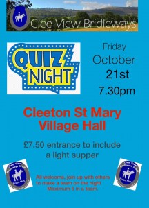
The Quiz was a great success and generated some much needed funds to pay for work that has already been done.
Thanks again to everyone involved !
Next Meeting
It was proposed that we have our “Christmas Meal” on Wed Jan 11th at the Fighting Cocks. Please put this in your diaries.
SUMMARY OF RIGHTS OF WAY – RESTORING THE RECORD
Why?
· In 2000, Parliament decided any old unrecorded ways should be extinguished to provide certainty to landowners
· But 25 years allowed for the legal record to be brought up-to-date
· Therefore any unrecorded ways will cease to exist in 2026
How are Public Rights of Way Recorded?
· Definitive maps
· Responsibility of the local authority to keep up-to-date
How to get the Definitive Map Updated
· Anyone can apply for a change to the definitive map
· Submit:
A completed application form
A map showing the route to be added or reclassified
Evidence to support the change
· If local authority agrees it makes a “definitive map modification order” – open for objections and, if received, determined by Inspector acting for Secretary of State
Different Approaches
· Research a particular route that has been regularly ridden – may be designated as a footpath
· Research a route that stops in the middle of nowhere for no apparent reason
· Research a whole geographical area for possible historical paths that are not defined on the current Ordnance Survey maps
Methods of Research
· The text details:
A suggested order, with separate methods for single routes or area-based research
Frequently consulted types of evidence – giving values and star ratings
The mechanics of making the application and the statutory forms
Helpful hints for records office visitors
A guide to archive and record offices
Questions to Answer
· Establish whether particular route(s) are to be researched or an area approach?
· Who is prepared to dedicate the time to do the research?
· What historical records are available within the group to do the initial investigation?
(n.b. Gill Eyre has some historical maps which Sally and Gill looked at briefly – John has a set of the current definitive maps for the area in large scale – the book is available to guide you through the process)
If the issue is different – e.g. the obstruction of a current designated bridleway (Cleeton Court) then this should be dealt with directly with the Local Authority Countryside Mapping and Enforcement Team